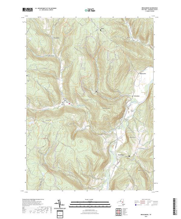
2023 Map of Breakabeen
USGS Topo · Published 2023About this map
Schoharie Creek dominates the valley floor, winding past the settlements of Fultonham and Breakabeen as it cuts through the highlands of Schoharie County. This area of central New York is characterized by its steep-walled hollows and ridges, including Towpath Mountain and Fulton Hill. The landscape preserves a record of 19th-century rural life through its distribution of family and community burial grounds, such as the Patria Cem and Ellis Cem, often situated near now-isolated hamlets like Patria and Vintonton. The presence of several small settlements including West Fulton and Watsonville suggests a historical reliance on the network of local creeks for early industry and transport, with Panther Creek and Keyser Kill draining the surrounding heights into the main Schoharie valley. The modern map also shows a developed network of recreation, featuring the Long Path Trl and various snowmobile corridors through Cole Hollow and over Rossman Hill.
Find a feature on this map
84 named features on this map. Tap any name to fly to it.
Don’t see what you’re looking for? This feature index may not catch every label — zoom into the map to look around manually.
Map Details
Editions of this 2023 Breakabeen Map
This is the sole edition of this map. No revisions or reprints were ever made.
Other maps of this area

1898 · Schoharie
USGS Topo · 1:62,500

1900 · Schoharie
USGS Topo · 1:62,500

1900 · Schoharie
USGS Topo · 1:31,680

1901 · Gilboa
USGS Topo · 1:62,500

1903 · Gilboa
USGS Topo · 1:62,500

1904 · Richmondville
USGS Topo · 1:62,500

1904 · Hobart
USGS Topo · 1:62,500

1943 · Cobleskill
USGS Topo · 1:24,000

1943 · Breakabeen
USGS Topo · 1:24,000
1943 · Schoharie
USGS Topo · 1:24,000