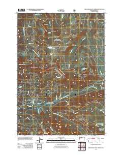
2011 Map of Breitenbush Hot Springs
USGS Topo · Published 2011About this map
Breitenbush Hot Springs serves as a focal point for this mountain landscape, where the North Fork Breitenbush River and South Fork Breitenbush River converge. The terrain is defined by its complex network of water and high-elevation meadows, including Round Meadow, Twin Meadows, and Cachebox Meadow. These open spaces are framed by prominent summits such as Collawash Mountain, Mansfield Mountain, and Devils Peak.
Find a feature on this map
41 named features on this map. Tap any name to fly to it.
Don’t see what you’re looking for? This feature index may not catch every label — zoom into the map to look around manually.
Map Details
Editions of this 2011 Breitenbush Hot Springs Map
This is the sole edition of this map. No revisions or reprints were ever made.
Other maps of this area

1927 · Mt. Jefferson
USGS Topo · 1:125,000

1929 · Mill City
USGS Topo · 1:125,000

1930 · Mt. Jefferson
USGS Topo · 1:125,000

1953 · Salem
USGS Topo · 1:250,000

1954 · Salem
USGS Topo · 1:250,000

1955 · Bend
USGS Topo · 1:250,000

1956 · Battle Ax
USGS Topo · 1:62,500

1956 · Detroit
USGS Topo · 1:62,500

1957 · Bend
USGS Topo · 1:250,000

1958 · Bend
USGS Topo · 1:250,000