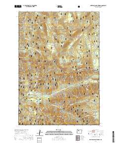
2020 Map of Breitenbush Hot Springs
USGS Topo · Published 2020About this map
Breitenbush Hot Springs and the small settlement of Breitenbush serve as the primary human touchpoints in this 2020 landscape dominated by the protected forests of the Cascade Range. Located at the meeting point of the Mount Hood National Forest and the Willamette National Forest, the area is defined by a dense network of hydrologic features including the Collawash Wild and Scenic River and the N Fork Breitenbush River. High-elevation landmarks like Hawk Mtn Lookout and Devils Peak overlook a terrain punctuated by mountain meadows such as Round Meadow and Twin Meadows. The map details the drainage patterns of numerous creeks and the positions of isolated alpine waters like Crown Lake and Claggett Lake, reflecting the remote character of this geothermal and timber-rich region of Marion County.
Find a feature on this map
66 named features on this map. Tap any name to fly to it.
Don’t see what you’re looking for? This feature index may not catch every label — zoom into the map to look around manually.
Map Details
Editions of this 2020 Breitenbush Hot Springs Map
This is the sole edition of this map. No revisions or reprints were ever made.
Other maps of this area

1927 · Mt. Jefferson
USGS Topo · 1:125,000

1929 · Mill City
USGS Topo · 1:125,000

1930 · Mt. Jefferson
USGS Topo · 1:125,000

1953 · Salem
USGS Topo · 1:250,000

1954 · Salem
USGS Topo · 1:250,000

1955 · Bend
USGS Topo · 1:250,000

1956 · Battle Ax
USGS Topo · 1:62,500

1956 · Detroit
USGS Topo · 1:62,500

1957 · Bend
USGS Topo · 1:250,000

1958 · Bend
USGS Topo · 1:250,000