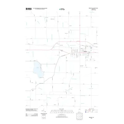
2013 Map of Bremen
USGS Topo · Published 2013About this map
Bremen is the primary hub of this North Central Indiana landscape, positioned where the CSX railroad corridor meets a complex network of agricultural drainage and natural waterways. The town's layout is defined by its grid, extending toward the Middle Fork Yellow River and Yellow River. Surrounding the urban center, the terrain is shaped by a dense system of man-made channels including the Sarah Hershberger Ditch, Isaac Sells Ditch, and George Bowser Ditch, illustrating the intensive land management required for local agriculture.
Find a feature on this map
103 named features on this map. Tap any name to fly to it.
Don’t see what you’re looking for? This feature index may not catch every label — zoom into the map to look around manually.
Map Details
Editions of this 2013 Bremen Map
This is the sole edition of this map. No revisions or reprints were ever made.
Other maps of this area

1953 · Chicago
USGS Topo · 1:250,000

1957 · Chicago
USGS Topo · 1:250,000

1957 · Inwood
USGS Topo · 1:24,000

1957 · Plymouth
USGS Topo · 1:24,000

1958 · Bremen
USGS Topo · 1:24,000

1958 · La Paz
USGS Topo · 1:24,000

1958 · Nappanee West
USGS Topo · 1:24,000

1958 · Bourbon
USGS Topo · 1:24,000

1958 · Lakeville
USGS Topo · 1:24,000
1961 · Wakarusa
USGS Topo · 1:24,000