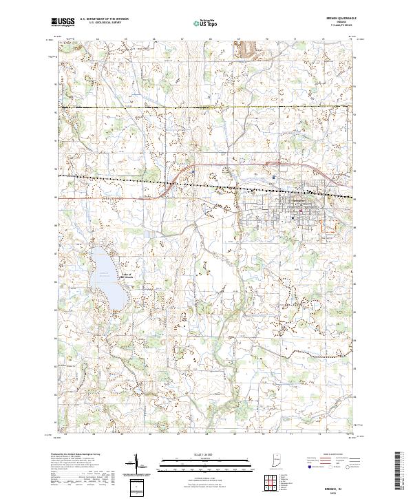
2022 Map of Bremen
USGS Topo · Published 2022About this map
The town of Bremen serves as the primary hub in this northern Indiana landscape, where the street grid expands southward from E North St toward E Lincoln St. This 2022 survey illustrates a region defined by its sophisticated agricultural drainage network, featuring numerous family-named waterways such as the Sarah Hershberger Ditch, John Mattern Ditch, and William Forsythe Ditch. These man-made channels support the productive farmland surrounding the community and feed into larger systems like the Yellow River and the Middle Fork Yellow River.
Find a feature on this map
55 named features on this map. Tap any name to fly to it.
Don’t see what you’re looking for? This feature index may not catch every label — zoom into the map to look around manually.
Map Details
Editions of this 2022 Bremen Map
This is the sole edition of this map. No revisions or reprints were ever made.
Other maps of this area

1953 · Chicago
USGS Topo · 1:250,000

1957 · Chicago
USGS Topo · 1:250,000

1957 · Inwood
USGS Topo · 1:24,000

1957 · Plymouth
USGS Topo · 1:24,000

1958 · Bremen
USGS Topo · 1:24,000

1958 · La Paz
USGS Topo · 1:24,000

1958 · Nappanee West
USGS Topo · 1:24,000

1958 · Bourbon
USGS Topo · 1:24,000

1958 · Lakeville
USGS Topo · 1:24,000
1961 · Wakarusa
USGS Topo · 1:24,000