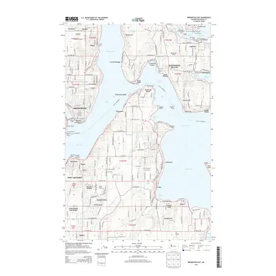
2014 Map of Bremerton East
USGS Topo · Published 2014About this map
Bainbridge Island and the eastern harbor of Bremerton dominate this maritime landscape where the Great Peninsula meets the complex waterways of Puget Sound. The map documents a heavily developed shoreline characterized by numerous points and passages, including the strategic narrows of Rich Passage and the industrial activity around the Bremerton Ferry Landing. Inland, the terrain is marked by established residential clusters like Illahee and Annapolis, which are interspersed with recreational spaces such as the Rolling Hills Golf Course.
Find a feature on this map
210 named features on this map. Tap any name to fly to it.
Don’t see what you’re looking for? This feature index may not catch every label — zoom into the map to look around manually.
Map Details
Editions of this 2014 Bremerton East Map
This is the sole edition of this map. No revisions or reprints were ever made.
Other maps of this area

1894 · Seattle
USGS Topo · 1:62,500

1895 · Snohomish
USGS Topo · 1:125,000

1897 · Tacoma
USGS Topo · 1:125,000

1897 · Seattle
USGS Topo · 1:125,000

1900 · Tacoma
USGS Topo · 1:125,000

1908 · Seattle
USGS Topo · 1:62,500

1909 · Seattle Special
USGS Topo · 1:62,500

1937 · Port Orchard
USGS Topo · 1:62,500

1942 · Gig Harbor
USGS Topo · 1:62,500

1943 · Gig Harbor
USGS Topo · 1:62,500