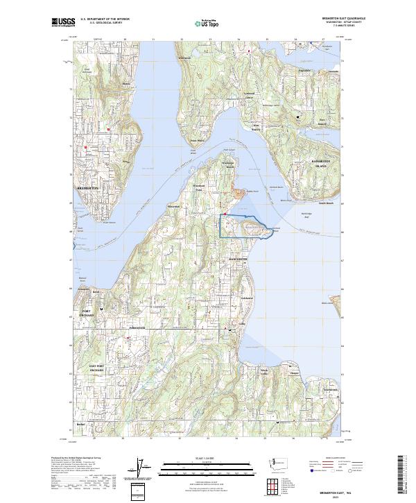
2023 Map of Bremerton East
USGS Topo · Published 2023About this map
Rich Passage and the waters of Port Orchard dominate this maritime landscape, where the Seattle - Bremerton Ferry connects the bustling urban centers of Bremerton and Port Orchard. Along the western shore of Bainbridge Island, the legacy of early industry and preservation is evident at the Minidoka National Historic Site and the historic waterfront of Port Blakely. The coastline is a series of named points and small inlets, from Point White to the heavy industrial infrastructure of the Shipyard near Sinclair Inlet.
Find a feature on this map
69 named features on this map. Tap any name to fly to it.
Don’t see what you’re looking for? This feature index may not catch every label — zoom into the map to look around manually.
Map Details
Editions of this 2023 Bremerton East Map
This is the sole edition of this map. No revisions or reprints were ever made.
Other maps of this area

1894 · Seattle
USGS Topo · 1:62,500

1895 · Snohomish
USGS Topo · 1:125,000

1897 · Tacoma
USGS Topo · 1:125,000

1897 · Seattle
USGS Topo · 1:125,000

1900 · Tacoma
USGS Topo · 1:125,000

1908 · Seattle
USGS Topo · 1:62,500

1909 · Seattle Special
USGS Topo · 1:62,500

1937 · Port Orchard
USGS Topo · 1:62,500

1942 · Gig Harbor
USGS Topo · 1:62,500

1943 · Gig Harbor
USGS Topo · 1:62,500