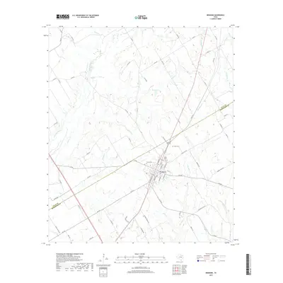
2019 Map of Bremond
USGS Topo · Published 2019About this map
Bremond stands as a central hub in Robertson County, defined by its grid of streets such as S Main St and Galveston St and its proximity to the border with Falls County. The settlement is surrounded by several significant burial sites, including the Bremond Cem and Saint Mary Cem, which offer important touchpoints for family history. The surrounding landscape is dominated by a complex network of waterways, with the Little Brazos River meandering through the western portion and numerous tributaries like Alligator Cr, Copperas Cr, and Willow Cr carving the terrain. A mix of rural farm-to-market roads and local routes like George Wachel Rd and Sand Mountain Rd connect the scattered homesteads and agricultural lands to the town center, while Wachel Lake serves as a prominent local landmark north of the main settlement.
Find a feature on this map
78 named features on this map. Tap any name to fly to it.
Don’t see what you’re looking for? This feature index may not catch every label — zoom into the map to look around manually.
Map Details
Editions of this 2019 Bremond Map
This is the sole edition of this map. No revisions or reprints were ever made.
Other maps of this area

1954 · Waco
USGS Topo · 1:250,000

1955 · Waco
USGS Topo · 1:250,000

1957 · McClanahan
USGS Topo · 1:24,000

1961 · Baileyville
USGS Topo · 1:24,000

1962 · Hammond
USGS Topo · 1:24,000

1962 · Reagan
USGS Topo · 1:24,000

1962 · Bremond
USGS Topo · 1:24,000

1962 · Petteway
USGS Topo · 1:24,000
1962 · Owensville
USGS Topo · 1:24,000

1965 · Kosse West
USGS Topo · 1:24,000