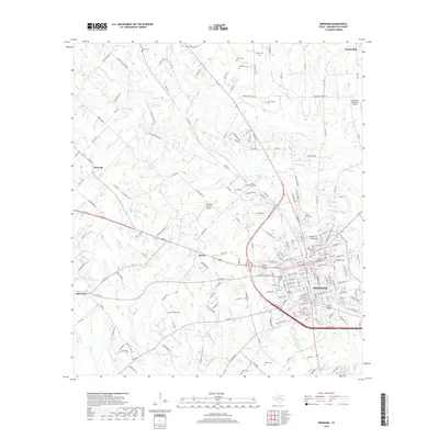
2019 Map of Brenham
USGS Topo · Published 2019About this map
Brenham serves as the focal point of this Washington County landscape, where the town's street grid meets the winding tributaries of the Brazos River watershed. The area is notable for its high density of burial grounds, providing a significant resource for genealogical research. Sites such as Yellow Fever Cem, Camptown Cem, and Willow Grove Cem are preserved alongside larger facilities like Prairie Lea Cem. Outside the central hub, the terrain is defined by its creek systems, including New Year Cr, Big Sandy Cr, and Sandy Cr, which historically influenced the development of surrounding communities like Berlin, Zionville, and Prairie Hill. Aviation interest is represented by the Brenham Municipal Airport to the northeast and the private Live Oak Ranch Airport further west. The map also traces various country roads and lanes, such as Hoddeville School Rd and Wauls Legion Rd, which connect rural homesteads to the municipal center.
Find a feature on this map
196 named features on this map. Tap any name to fly to it.
Don’t see what you’re looking for? This feature index may not catch every label — zoom into the map to look around manually.
Map Details
Editions of this 2019 Brenham Map
This is the sole edition of this map. No revisions or reprints were ever made.
Other maps of this area

1914 · Gay Hill
USGS Topo · 1:62,500

1930 · Brenham
USGS Topo · 1:62,500

1954 · Austin
USGS Topo · 1:250,000

1956 · Brenham
USGS Topo · 1:62,500

1956 · Somerville
USGS Topo · 1:62,500

1958 · Greenvine
USGS Topo · 1:24,000

1958 · Burton
USGS Topo · 1:24,000

1959 · Gay Hill
USGS Topo · 1:24,000

1959 · Somerville
USGS Topo · 1:24,000

1959 · Independence
USGS Topo · 1:24,000