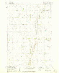
1960 Map of Brentford SE
USGS Topo · Published 1961About this map
The townships of Tetonka and Clifton define this rural landscape of Spink County during the early 1960s. Surveyed as part of the Missouri River Basin development program, the area is characterized by the meandering path of Dry Run, which snakes through the central plains. Local civic and community history is anchored by the presence of a Townhall and two burial grounds, Baldwin Cem in the north and Clifton Cem to the south. The map provides a distinct look at the agricultural infrastructure of the era, noting several instances of a Flowing Well scattered across the township sections. These water sources and the detailed network of fence and field lines reflect the mid-century farming patterns before modern center-pivot irrigation became the dominant feature of the South Dakota prairie.
Find a feature on this map
7 named features on this map. Tap any name to fly to it.
Don’t see what you’re looking for? This feature index may not catch every label — zoom into the map to look around manually.
Map Details
Editions of this 1960 Brentford SE Map
This is the sole edition of this map. No revisions or reprints were ever made.
Other maps of this area

1894 · Conde
USGS Topo · 1:62,500

1895 · Byron
USGS Topo · 1:125,000

1895 · Aberdeen
USGS Topo · 1:125,000

1953 · Brentford
USGS Topo · 1:24,000

1953 · Frankfort
USGS Topo · 1:24,000

1953 · Gallup
USGS Topo · 1:24,000

1953 · Ashton
USGS Topo · 1:24,000

1953 · Huron
USGS Topo · 1:250,000

1954 · Mellette
USGS Topo · 1:24,000

1954 · Aberdeen
USGS Topo · 1:250,000