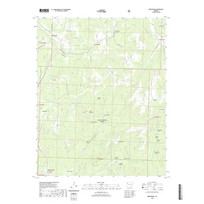
2020 Map of Brentwood
USGS Topo · Published 2020About this map
Ozark National Forest dominates the high, dissected plateau south of Brentwood, where the headwaters of several major river systems originate. The terrain is defined by deep hollows like Paschal Hollow and Gabbard Hollow, which separate prominent heights such as Henderson Mtn and Weedy Rough Mtn. This area serves as a significant drainage divide; the W Fork White River flows north toward the White River basin, while Frog Bayou drains the southern slopes toward the Arkansas River.
Find a feature on this map
80 named features on this map. Tap any name to fly to it.
Don’t see what you’re looking for? This feature index may not catch every label — zoom into the map to look around manually.
Map Details
Editions of this 2020 Brentwood Map
This is the sole edition of this map. No revisions or reprints were ever made.
Other maps of this area

1879 · Cravens
USGS Topo · 1:62,500

1887 · Watalula
USGS Topo · 1:62,500

1898 · Winslow #4
USGS Topo · 1:62,500

1898 · Winslow
USGS Topo · 1:125,000

1901 · Winslow
USGS Topo · 1:125,000

1939 · Watalula
USGS Topo · 1:62,500

1943 · St. Paul
USGS Topo · 1:62,500

1946 · St. Paul
USGS Topo · 1:62,500

1946 · Fort Smith
USGS Topo · 1:250,000

1956 · Russellville
USGS Topo · 1:250,000