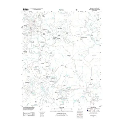
2011 Map of Brevard
USGS Topo · Published 2011About this map
Brevard serves as the central hub of this 2011 survey, surrounded by established neighborhoods like Franklin Park, McCrary Acres, and Forest Hills. The landscape is defined by the winding course of the French Broad River and the Little River, which are punctuated by numerous small dams and private lakes including Cascade Lake, Trout Lake, and Betty Kay Lake. Cultural history is preserved in many family and community burial grounds, such as the Evergreen Gillespie Cemetery and Cooper Cemetery, often situated near prominent peaks like Sugar Loaf Mountain or See Off Mountain. The southern portion of the map highlights planned recreational and residential areas such as Sherwood Forest and Sequoyah Woods, illustrating the region's transition into a destination for summer camps and seasonal retreats. Notable landmarks such as the Brevard Airport and the historic Linden Tree Manor provide clear evidence of the community's early twentieth-century development and aviation history.
Find a feature on this map
212 named features on this map. Tap any name to fly to it.
Don’t see what you’re looking for? This feature index may not catch every label — zoom into the map to look around manually.
Map Details
Editions of this 2011 Brevard Map
This is the sole edition of this map. No revisions or reprints were ever made.
Other maps of this area

1905 · Pisgah
USGS Topo · 1:125,000

1906 · Pisgah
USGS Topo · 1:125,000

1935 · Brevard
USGS Topo · 1:24,000

1935 · Eastatoe Gap
USGS Topo · 1:24,000

1935 · Standingstone Mtn.
USGS Topo · 1:24,000

1935 · Horse Shoe
USGS Topo · 1:24,000

1935 · Rosman
USGS Topo · 1:24,000

1935 · Table Rock
USGS Topo · 1:24,000

1935 · Shining Rock
USGS Topo · 1:24,000

1935 · Pisgah Forest
USGS Topo · 1:24,000