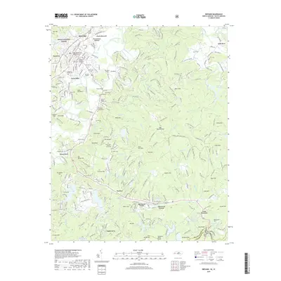
2019 Map of Brevard
USGS Topo · Published 2019About this map
The French Broad River winds through the northern reaches of this Transylvania County landscape, where the city of Brevard serves as a gateway to the Pisgah National Forest. This 2019 survey captures a complex intersection of mountain topography and established communities, extending from North Brevard and Broadview Estates southward toward the South Carolina border. The area is notable for its dense concentration of historical religious sites and burial grounds, including the Brevard Davidson River Presbyterian Church Memorial Garden and the Saint Paul's in the Valley Episcopal Cem.
Find a feature on this map
253 named features on this map. Tap any name to fly to it.
Don’t see what you’re looking for? This feature index may not catch every label — zoom into the map to look around manually.
Map Details
Editions of this 2019 Brevard Map
This is the sole edition of this map. No revisions or reprints were ever made.
Other maps of this area

1905 · Pisgah
USGS Topo · 1:125,000

1906 · Pisgah
USGS Topo · 1:125,000

1935 · Brevard
USGS Topo · 1:24,000

1935 · Eastatoe Gap
USGS Topo · 1:24,000

1935 · Standingstone Mtn.
USGS Topo · 1:24,000

1935 · Horse Shoe
USGS Topo · 1:24,000

1935 · Rosman
USGS Topo · 1:24,000

1935 · Table Rock
USGS Topo · 1:24,000

1935 · Shining Rock
USGS Topo · 1:24,000

1935 · Pisgah Forest
USGS Topo · 1:24,000