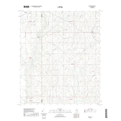
2018 Map of Brewer
USGS Topo · Published 2018About this map
Sand Hill and Brewer anchor this rural landscape along the boundary of Perry and Greene counties in southeastern Mississippi. The terrain is defined by a dense network of tributaries including Gaines Creek, Fivemile Creek, and Beetree Creek that weave through low-lying swampy bottoms. A strong sense of local genealogy and community history is preserved through numerous family-named roads such as Loarne Morris Freeman Road, Bill Merritt Road, and Brownlee Road. The Gaines Brewer Road Bridge spans the water near the Frisco Cemetery, while the eastern portion of the quadrangle is marked by Sand Hill Cemetery and the intersection of Chap Smith road. This area remains characterized by its remote timberlands and traditional land divisions, with property lines often following the winding paths of branches like Yellow Jacket Branch and Newcomb Branch.
Find a feature on this map
61 named features on this map. Tap any name to fly to it.
Don’t see what you’re looking for? This feature index may not catch every label — zoom into the map to look around manually.
Map Details
Editions of this 2018 Brewer Map
This is the sole edition of this map. No revisions or reprints were ever made.
Other maps of this area

1947 · Beaumont
USGS Topo · 1:62,500

1949 · Beaumont
USGS Topo · 1:62,500

1953 · Hattiesburg
USGS Topo · 1:250,000

1958 · Hattiesburg
USGS Topo · 1:250,000

1963 · Brewer
USGS Topo · 1:24,000

1964 · Rhodes
USGS Topo · 1:24,000

1964 · Richton
USGS Topo · 1:24,000

1964 · Mulberry
USGS Topo · 1:24,000

1964 · Avera
USGS Topo · 1:24,000

1964 · Piave
USGS Topo · 1:24,000