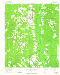
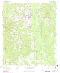
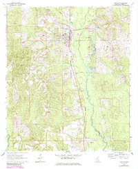
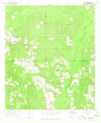
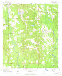
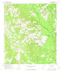
1964 Map of Richton
USGS Topo · Published 1965About this map
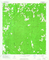
The Gulf Mobile And Ohio railroad serves as the central spine of this 1964 survey, cutting through the town of Richton and the rural community of Hintonville. The landscape transitions from the developed grid of Richton to the surrounding timberlands and drainages of Thompson Creek and Beaver Dam Creek. Local genealogy and land use patterns are well-preserved through numerous country churches and family-linked sites, including Clay Hill Ch, Holy Hill Ch, and the Isaiah Hinton Cem. Industrial activity is concentrated in numerous Gravel Pits and several Oil Wells scattered through the southern sections. Notable landmarks like the Richton Lookout Tower and the Sunset Cem near the town center offer specific points of interest for researchers tracing the mid-century development of Perry County.
Find a feature on this map
29 named features on this map. Tap any name to fly to it.
Don’t see what you’re looking for? This feature index may not catch every label — zoom into the map to look around manually.
Map Details
Editions of this 1964 Richton Map
3 editions found
Other maps of this area

1947 · Beaumont
USGS Topo · 1:62,500

1947 · New Augusta
USGS Topo · 1:62,500

1949 · Beaumont
USGS Topo · 1:62,500

1949 · New Augusta
USGS Topo · 1:62,500

1953 · Hattiesburg
USGS Topo · 1:250,000

1958 · Hattiesburg
USGS Topo · 1:250,000
1963 · Brewer
USGS Topo · 1:24,000
1964 · Rhodes
USGS Topo · 1:24,000
1964 · Ovett SE
USGS Topo · 1:24,000
1964 · Ovett
USGS Topo · 1:24,000