2023 Map of Brewerton
USGS Topo · Published 2023About this map
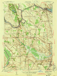
The Oneida River meanders through the heart of this Onondaga and Oswego county borderland, defining the geography between Sand Ridge and Cicero. This modern survey illustrates the persistent importance of the waterway and its surrounding lowlands, including the sprawling Peat Swamp and islands like Schroeppel Island and Glosky Island. The settlement pattern follows a mix of established hamlet centers and newer suburban developments, with Oak Orchard and Euclid serving as primary junctions.
Find a feature on this map
42 named features on this map. Tap any name to fly to it.
Don’t see what you’re looking for? This feature index may not catch every label — zoom into the map to look around manually.
Map Details
Editions of this 2023 Brewerton Map
This is the sole edition of this map. No revisions or reprints were ever made.
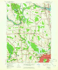
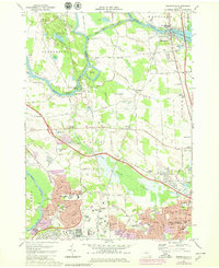
Historical Maps of North Syracuse Through Time
5 maps found