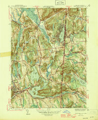
1946 Map of Brewster
USGS Topo · Published 1946About this map
Bog Brook Reservoir and the East Branch Reservoir dominate this 1946 landscape, highlighting the critical role of the Croton watershed in regional water management. The area is characterized by a mix of established crossroads and emerging communities, such as Putnam Lake and the interestingly named settlement of Sodom. High ground like Titicus Mtn and Dykemans Mtn overlooks a dense network of valley transport, where the New York Central and the New York New Haven and Hartford railroads converge near Brewster. Local heritage is well-preserved through numerous family-named landmarks and historical sites, including Mendel Pd, Steinbeck Cors, and the Big Elm Sch. The map also captures several community anchors such as the YMCA Camp and Union Cem, providing a detailed look at the social and physical geography of Putnam County just after the war.
Find a feature on this map
65 named features on this map. Tap any name to fly to it.
Don’t see what you’re looking for? This feature index may not catch every label — zoom into the map to look around manually.
Map Details
Editions of this 1946 Brewster Map
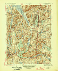
2 editions found
Other maps of this area

1892 · Danbury
USGS Topo · 1:62,500

1892 · New Milford
USGS Topo · 1:62,500

1892 · Carmel
USGS Topo · 1:62,500

1893 · Carmel
USGS Topo · 1:62,500

1893 · New Milford
USGS Topo · 1:62,500

1893 · Clove
USGS Topo · 1:62,500

1894 · Clove
USGS Topo · 1:62,500

1894 · Carmel
USGS Topo · 1:62,500

1898 · Clove
USGS Topo · 1:62,500

1901 · Clove
USGS Topo · 1:62,500