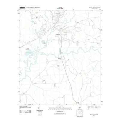
2011 Map of Brewton South
USGS Topo · Published 2011About this map
The Conecuh River and Murder Creek converge south of the city centers, anchoring the landscape of Escambia County. This area represents a critical junction where the urban infrastructure of Brewton and East Brewton transitions into the riverine wetlands and agricultural lands of the south. The presence of Fort Crawford Cemetery highlights the deep territorial history of the region, while modern industrial elements like the Container Corporation Treatment P reflect the local economy's reliance on the surrounding timber and water resources. To the south, the settlement of Dixonville and the Brewton Municipal Airport mark the southern reach of the developed corridor. Numerous family and community burial grounds, such as Baptist Hill Cemetery and Odom Cemetery, are scattered across the terrain, offering significant touchpoints for genealogists tracing the established families of the Alabama-Florida borderlands.
Find a feature on this map
105 named features on this map. Tap any name to fly to it.
Don’t see what you’re looking for? This feature index may not catch every label — zoom into the map to look around manually.
Map Details
Editions of this 2011 Brewton South Map
This is the sole edition of this map. No revisions or reprints were ever made.
Other maps of this area

1943 · Jay
USGS Topo · 1:62,500

1948 · Munson
USGS Topo · 1:62,500

1950 · Munson
USGS Topo · 1:62,500

1953 · Andalusia
USGS Topo · 1:250,000

1957 · Andalusia
USGS Topo · 1:250,000

1957 · Pensacola
USGS Topo · 1:250,000

1959 · Pensacola
USGS Topo · 1:250,000

1959 · Brewton South
USGS Topo · 1:24,000

1960 · Pensacola
USGS Topo · 1:250,000

1960 · Brewton South
USGS Topo · 1:24,000