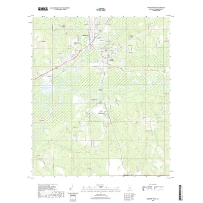
2018 Map of Brewton South
USGS Topo · Published 2018About this map
Murder Creek and the Conecuh River converge south of Brewton, defining the geography of this Escambia County landscape. The area is marked by a dense concentration of historical burial grounds, including the Baptist Hill Cem, Union Cem, and the Fort Crawford Cem, which point to generations of local settlement. Modern infrastructure such as the Brewton Municipal Airport and the naval outlying field NOLF Brewton sit alongside legacy transport routes like the L & N RR. South of the main settlements of East Brewton and Riverview, the terrain softens into a network of wetlands and oxbow lakes, including Brantley Lake and Foshee Lake, while Jefferson Davis Community College serves as a prominent institutional landmark near the heart of the city.
Find a feature on this map
128 named features on this map. Tap any name to fly to it.
Don’t see what you’re looking for? This feature index may not catch every label — zoom into the map to look around manually.
Map Details
Editions of this 2018 Brewton South Map
This is the sole edition of this map. No revisions or reprints were ever made.
Other maps of this area

1943 · Jay
USGS Topo · 1:62,500

1948 · Munson
USGS Topo · 1:62,500

1950 · Munson
USGS Topo · 1:62,500

1953 · Andalusia
USGS Topo · 1:250,000

1957 · Andalusia
USGS Topo · 1:250,000

1957 · Pensacola
USGS Topo · 1:250,000

1959 · Pensacola
USGS Topo · 1:250,000

1959 · Brewton South
USGS Topo · 1:24,000

1960 · Pensacola
USGS Topo · 1:250,000

1960 · Brewton South
USGS Topo · 1:24,000