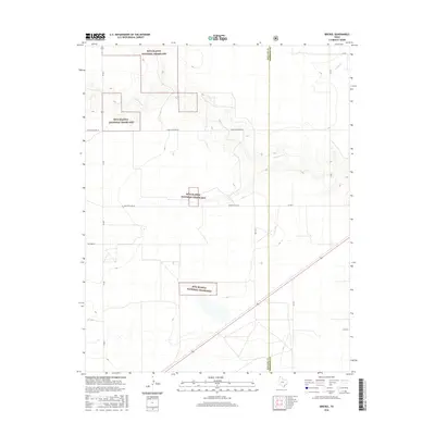
2016 Map of Brickel
USGS Topo · Published 2016About this map
Rita Blanca National Grassland dominates this portion of the Texas Panhandle, with several non-contiguous parcels managed by the U.S. Forest Service. The terrain is characterized by the drainage patterns of Coldwater Cr and Frisco Cr, which carve subtle relief into the High Plains landscape. The map illustrates a strictly organized grid of rural infrastructure, where ranch roads such as E High Lonesome Rd and Country Club Ln intersect with FM 807. This 2016 survey captures the boundary between Dallam Co and Sherman Co, documenting a region defined by large-scale conservation and sparse agricultural settlement. The presence of numerous wetlands and stock tanks throughout the grassland areas reflects the critical role of water management in this arid environment.
Find a feature on this map
16 named features on this map. Tap any name to fly to it.
Don’t see what you’re looking for? This feature index may not catch every label — zoom into the map to look around manually.
Map Details
Editions of this 2016 Brickel Map
This is the sole edition of this map. No revisions or reprints were ever made.
Other maps of this area

1954 · Dalhart
USGS Topo · 1:250,000

1958 · Dalhart
USGS Topo · 1:250,000

1962 · Dalhart
USGS Topo · 1:250,000

1964 · Brickel
USGS Topo · 1:24,000

1964 · Kerrick
USGS Topo · 1:24,000

1964 · Stratford 2 SE
USGS Topo · 1:24,000

1964 · Stratford 2 NE
USGS Topo · 1:24,000

1964 · Stratford
USGS Topo · 1:24,000

1964 · Stratford NE
USGS Topo · 1:24,000

1965 · Lautz
USGS Topo · 1:24,000