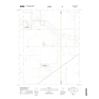
2019 Map of Brickel
USGS Topo · Published 2019About this map
Rita Blanca National Grassland dominates this portion of the Texas Panhandle, where the high plains meet the headwaters of regional drainage systems. The landscape is defined by the winding course of Coldwater Creek and Frisco Creek, which provide significant relief to the otherwise flat terrain of Sherman and Dallam counties. This 2019 survey shows a sparsely populated area where the primary human footprint consists of a grid-like road network, including the evocative E High Lonesome Rd and Texas St. The inclusion of Country Club Ln and Little Rd suggests localized development amidst the vast grazing lands, while the RB NG abbreviation indicates secondary parcels of the national grassland. It is a clear portrait of contemporary land management and rural connectivity in the northernmost reaches of Texas.
Find a feature on this map
17 named features on this map. Tap any name to fly to it.
Don’t see what you’re looking for? This feature index may not catch every label — zoom into the map to look around manually.
Map Details
Editions of this 2019 Brickel Map
This is the sole edition of this map. No revisions or reprints were ever made.
Other maps of this area

1954 · Dalhart
USGS Topo · 1:250,000

1958 · Dalhart
USGS Topo · 1:250,000

1962 · Dalhart
USGS Topo · 1:250,000

1964 · Brickel
USGS Topo · 1:24,000

1964 · Kerrick
USGS Topo · 1:24,000

1964 · Stratford 2 SE
USGS Topo · 1:24,000

1964 · Stratford 2 NE
USGS Topo · 1:24,000

1964 · Stratford
USGS Topo · 1:24,000

1964 · Stratford NE
USGS Topo · 1:24,000

1965 · Lautz
USGS Topo · 1:24,000