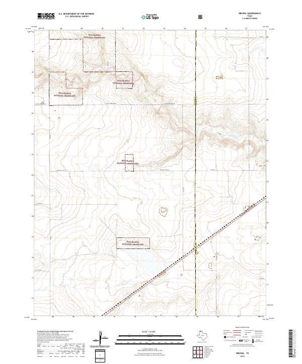
2022 Map of Brickel
USGS Topo · Published 2022About this map
Rita Blanca National Grassland segments dominate this Panhandle landscape, where the high plains are carved by the drainage of Coldwater Cr and Frisco Cr. The map reveals a strictly regulated grid of section roads and cattle-country lanes on the border of Dallam and Sherman counties. Notable local thoroughfares include E High Lonesome Rd and Country Club Ln, reflecting the isolation and naming conventions of this agricultural region. The modern infrastructure, such as Texas St and FM 807, highlights the essential transport routes connecting these remote parcels. This 2022 survey captures the persistent rural character of the region, where land management boundaries intersect with intermittent watercourses and traditional ranching roads like Willard Ln.
Find a feature on this map
17 named features on this map. Tap any name to fly to it.
Don’t see what you’re looking for? This feature index may not catch every label — zoom into the map to look around manually.
Map Details
Editions of this 2022 Brickel Map
This is the sole edition of this map. No revisions or reprints were ever made.
Other maps of this area

1954 · Dalhart
USGS Topo · 1:250,000

1958 · Dalhart
USGS Topo · 1:250,000

1962 · Dalhart
USGS Topo · 1:250,000

1964 · Brickel
USGS Topo · 1:24,000

1964 · Kerrick
USGS Topo · 1:24,000

1964 · Stratford 2 SE
USGS Topo · 1:24,000

1964 · Stratford 2 NE
USGS Topo · 1:24,000

1964 · Stratford
USGS Topo · 1:24,000

1964 · Stratford NE
USGS Topo · 1:24,000

1965 · Lautz
USGS Topo · 1:24,000