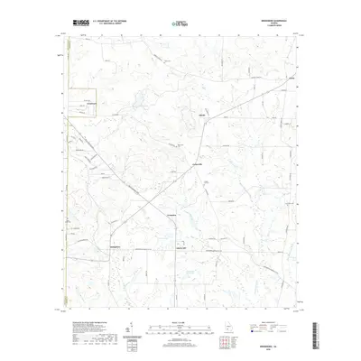
2020 Map of Bridgeboro
USGS Topo · Published 2020About this map
Bridgeboro and the surrounding coastal plain of Worth County are defined by a network of agricultural lands and creek-fed wetlands. This 2020 landscape shows a mix of small crossroads communities including Alfords, Parkerville, and Livingston, often centered near family-named landmarks and historical burial grounds. The water system is particularly intricate, with the Ochlockonee River and Little Ochlockonee River carving through the eastern and southern reaches of the quadrangle. Local genealogists will find significant value in the distribution of remote cemeteries like Parkerville Cem, Chapel Hill Cem, and Rocky Mount Cem. Large water bodies such as Jenkins Lake, Sears Lake, and Varnadoe North Lake illustrate the area's hydrology, while the intersection of the Billy Langdale Pkwy and Gintown Rd marks the modern transportation corridors through these traditional rural settlements.
Find a feature on this map
70 named features on this map. Tap any name to fly to it.
Don’t see what you’re looking for? This feature index may not catch every label — zoom into the map to look around manually.
Map Details
Editions of this 2020 Bridgeboro Map
This is the sole edition of this map. No revisions or reprints were ever made.
Other maps of this area

1953 · Dothan
USGS Topo · 1:250,000

1953 · Waycross
USGS Topo · 1:250,000

1954 · Dothan
USGS Topo · 1:250,000

1955 · Dothan
USGS Topo · 1:250,000

1956 · Albany East
USGS Topo · 1:24,000

1956 · Baconton
USGS Topo · 1:62,500

1956 · Sylvester
USGS Topo · 1:62,500

1956 · Doerun
USGS Topo · 1:62,500

1956 · Albany
USGS Topo · 1:62,500

1958 · Waycross
USGS Topo · 1:250,000