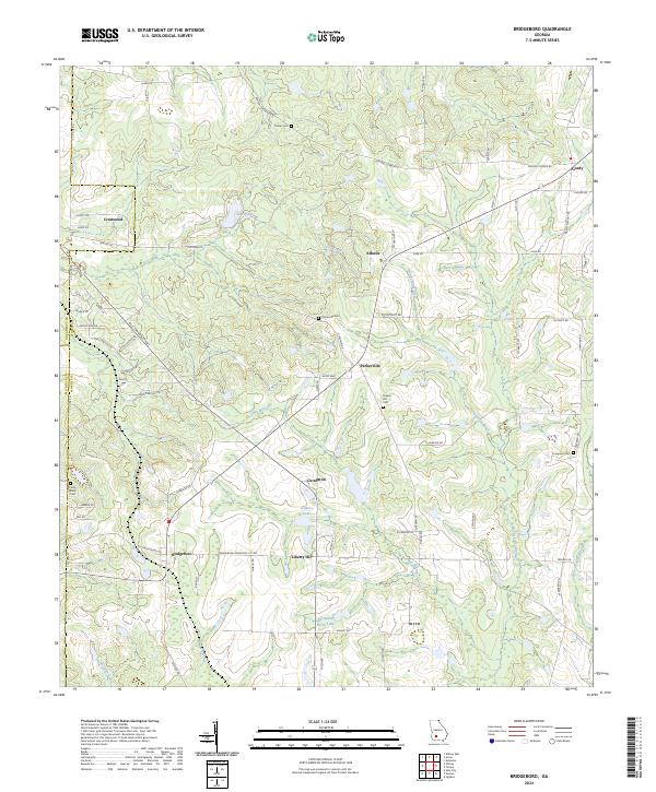
2024 Map of Bridgeboro
USGS Topo · Published 2024About this map
Bridgeboro serves as the focal point for this Southwest Georgia landscape, where agricultural land meets the drainage systems of the Ochlockonee River and the Little Ochlockonee River. The terrain is defined by low-lying watercourses such as Dry Creek and Bay Branch, which weave between small settlements like Livingston and Liberty Hill. Family and community history is preserved in numerous burial sites scattered across the township, including Parker Cem, Parkerville Cem, and Chapel Hill Cem.
Find a feature on this map
70 named features on this map. Tap any name to fly to it.
Don’t see what you’re looking for? This feature index may not catch every label — zoom into the map to look around manually.
Map Details
Editions of this 2024 Bridgeboro Map
This is the sole edition of this map. No revisions or reprints were ever made.
Other maps of this area

1953 · Dothan
USGS Topo · 1:250,000

1953 · Waycross
USGS Topo · 1:250,000

1954 · Dothan
USGS Topo · 1:250,000

1955 · Dothan
USGS Topo · 1:250,000

1956 · Albany East
USGS Topo · 1:24,000

1956 · Baconton
USGS Topo · 1:62,500

1956 · Sylvester
USGS Topo · 1:62,500

1956 · Doerun
USGS Topo · 1:62,500

1956 · Albany
USGS Topo · 1:62,500

1958 · Waycross
USGS Topo · 1:250,000