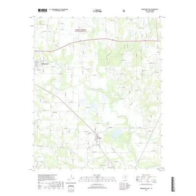
2019 Map of Bridgeport East
USGS Topo · Published 2019About this map
The Lyndon B. Johnson National Grassland dominates the northern landscape of this Wise County region, providing a significant tract of protected prairie and woodland above the city of Bridgeport. The terrain is defined by the winding course of the West Fork Trinity River, which flows through the southern half of the quadrangle. This drainage system is supported by numerous tributaries, including Big Sandy Cr, Waggoner Br, and Martin Br, illustrating the riparian network that has influenced local land use and development patterns in North Texas.
Find a feature on this map
118 named features on this map. Tap any name to fly to it.
Don’t see what you’re looking for? This feature index may not catch every label — zoom into the map to look around manually.
Map Details
Editions of this 2019 Bridgeport East Map
This is the sole edition of this map. No revisions or reprints were ever made.
Other maps of this area

1924 · Sunset 4-d
USGS Topo · 1:48,000

1930 · Boyd
USGS Topo · 1:62,500

1954 · Sherman
USGS Topo · 1:250,000

1958 · Sherman
USGS Topo · 1:250,000

1960 · Bridgeport West
USGS Topo · 1:24,000

1960 · Bridgeport East
USGS Topo · 1:24,000

1960 · Decatur
USGS Topo · 1:24,000

1960 · Boyd
USGS Topo · 1:24,000

1960 · Cottondale
USGS Topo · 1:24,000
1960 · Boonsville
USGS Topo · 1:24,000