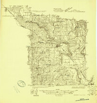
1924 Map of Sunset 4-d
USGS Topo · Published 1924About this map
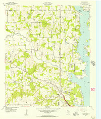
The West Fork Trinity River winds through the heart of southern Wise County, creating a broad floodplain that dominates this 1924 landscape. This survey captures a rural Texas society defined by its community education system, featuring a remarkable density of local institutions such as Flatwood School, Arkansas School, and Pleasant Grove School scattered across the countryside. The Chicago Rock Island and Gulf railroad serves as the primary industrial corridor, connecting the established settlements of Paradise, Boyd, and Aurora. Beyond the iron rails, the terrain is carved by numerous tributaries like Hog Creek, Deep Creek, and Salt Cr, highlighting the importance of natural drainage and water access for the early 20th-century agrarian economy. The presence of smaller hamlets like Anneville alongside these rural schoolhouses provides a detailed record of local geography before the consolidation of rural communities later in the century.
Find a feature on this map
21 named features on this map. Tap any name to fly to it.
Don’t see what you’re looking for? This feature index may not catch every label — zoom into the map to look around manually.
Map Details
Editions of this 1924 Sunset 4-d Map
This is the sole edition of this map. No revisions or reprints were ever made.
Other maps of this area

1891 · Weatherford
USGS Topo · 1:125,000

1893 · Weatherford
USGS Topo · 1:125,000

1894 · Fort Worth
USGS Topo · 1:125,000
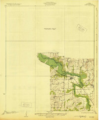
1930 · Boyd
USGS Topo · 1:62,500
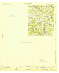
1932 · Springtown
USGS Topo · 1:62,500

1954 · Dallas
USGS Topo · 1:250,000

1954 · Sherman
USGS Topo · 1:250,000
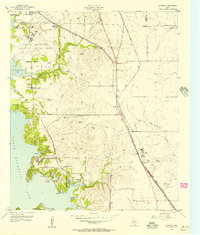
1955 · Avondale
USGS Topo · 1:24,000
1955 · Azle
USGS Topo · 1:24,000

1955 · Haltom City
USGS Topo · 1:62,500