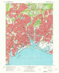
1970 Map of Bridgeport
USGS Topo · Published 1972About this map
Bridgeport and its coastal neighbors are captured here at a moment of significant mid-century infrastructure expansion. The landscape is defined by the dense residential and industrial corridors branching away from Bridgeport Harbor, where the Penn Central rail lines and the Connecticut Turnpike cut through established neighborhoods like Black Rock and Newfield. This 1970 revision shows the heavy concentration of civic life in the city core, from the Federal Courthouse and St Augustine Cathedral to the sprawling grounds of Mount Grove Cemetery. To the north, the terrain transitions into the more suburbanized areas of Trumbull and Easton, marked by recreational landmarks such as Fairchild-Wheeler Park and the academic campus of Sacred Heart University. Along the coast, the industrial nature of the Housatonic River mouth is visible near Great Meadows and the Bridgeport Municipal Airport.
Find a feature on this map
156 named features on this map. Tap any name to fly to it.
Don’t see what you’re looking for? This feature index may not catch every label — zoom into the map to look around manually.
Map Details
Editions of this 1970 Bridgeport Map
4 editions found
Other maps of this area

1889 · Derby
USGS Topo · 1:62,500

1891 · Bridgeport
USGS Topo · 1:62,500

1891 · Derby
USGS Topo · 1:62,500

1892 · Danbury
USGS Topo · 1:62,500

1892 · Norwalk
USGS Topo · 1:62,500

1893 · Bridgeport
USGS Topo · 1:62,500

1893 · Norwalk
USGS Topo · 1:62,500

1893 · Derby
USGS Topo · 1:62,500

1915 · Danbury
USGS Topo · 1:62,500

1920 · Bridgeport
USGS Topo · 1:62,500