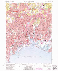
1970 Map of Bridgeport
USGS Topo · Published 1988About this map
The industrial and coastal identity of Bridgeport is captured in high detail as it appeared in 1970, showing a landscape defined by its harbor and deep-seated transportation networks. The dense urban core radiates from the Pequonnock River and Yellow Mill Pond, where heavy rail lines for Amtrak and Conrail intersect with the modern corridor of Interstate 95. To the east, the Igor Sikorsky Memorial Airport sits at the edge of the Great Meadows, highlighting the city's role in aviation history.
Find a feature on this map
175 named features on this map. Tap any name to fly to it.
Don’t see what you’re looking for? This feature index may not catch every label — zoom into the map to look around manually.
Map Details
Editions of this 1970 Bridgeport Map
4 editions found
Other maps of this area

1889 · Derby
USGS Topo · 1:62,500

1891 · Bridgeport
USGS Topo · 1:62,500

1891 · Derby
USGS Topo · 1:62,500

1892 · Danbury
USGS Topo · 1:62,500

1892 · Norwalk
USGS Topo · 1:62,500

1893 · Bridgeport
USGS Topo · 1:62,500

1893 · Norwalk
USGS Topo · 1:62,500

1893 · Derby
USGS Topo · 1:62,500

1915 · Danbury
USGS Topo · 1:62,500

1920 · Bridgeport
USGS Topo · 1:62,500