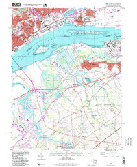
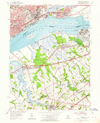
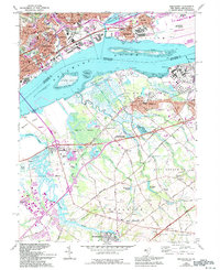
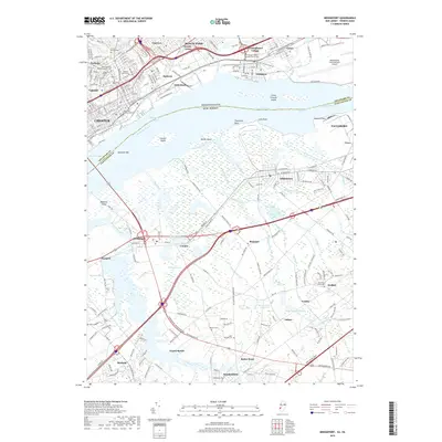
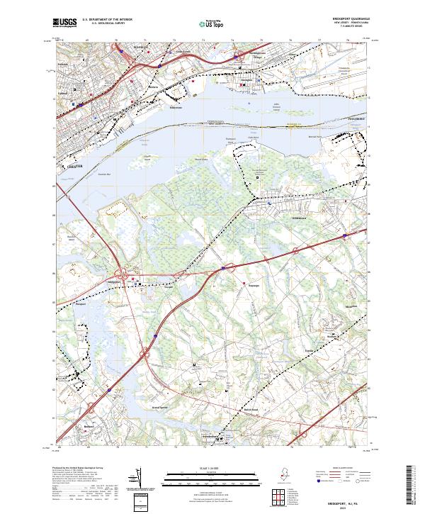
1995 Map of Bridgeport
USGS Topo · Published 1999About this map
The industrial corridor of the Delaware River anchors this mid-1990s survey, showing the complex interplay between heavy transportation and coastal wetlands. On the Pennsylvania shore, the dense urban grid of Chester is visible, featuring landmarks like the Crozer Seminary and Pennsylvania Mil College alongside Westinghouse Village. Across the water in New Jersey, the landscape shifts from the industrial docks of Paulsboro and Gibbstown to the expansive Cedar Swamp. This map provides a detailed view of the infrastructure supporting the region, including the Conrail rail lines and the Seaplane Base near Essington. Inland, the survey preserves the locations of older rural landmarks such as Solomons Graveyard, Hendrickson Millpond, and several family-named cemeteries that predate the suburban expansion of the late 20th century.
Find a feature on this map
95 named features on this map. Tap any name to fly to it.
Don’t see what you’re looking for? This feature index may not catch every label — zoom into the map to look around manually.
Map Details
Editions of this 1995 Bridgeport Map
This is the sole edition of this map. No revisions or reprints were ever made.
Historical Maps of Chester Through Time
11 maps found
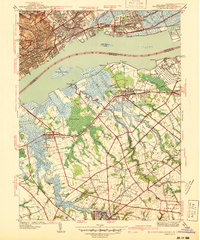
1940 Bridgeport
Gloucester County, NJ
1941 Bridgeport
Gloucester County, NJ
1944 Bridgeport
Gloucester County, NJ
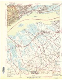
1953 Bridgeport
Gloucester County, NJ
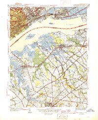
1967 Bridgeport
Gloucester County, NJ
1995 Bridgeport
Gloucester County, NJ
2011 Bridgeport
Gloucester County, NJ

2014 Bridgeport
Gloucester County, NJ
2016 Bridgeport
Gloucester County, NJ
2019 Bridgeport
Gloucester County, NJ
2023 Bridgeport
Gloucester County, NJ