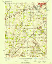
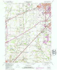
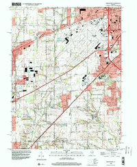
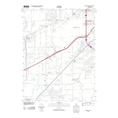
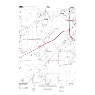
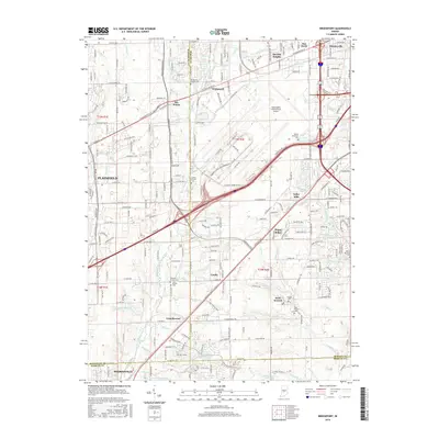
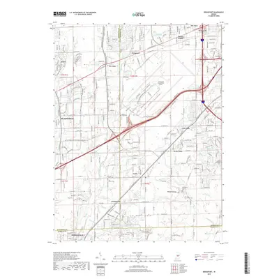
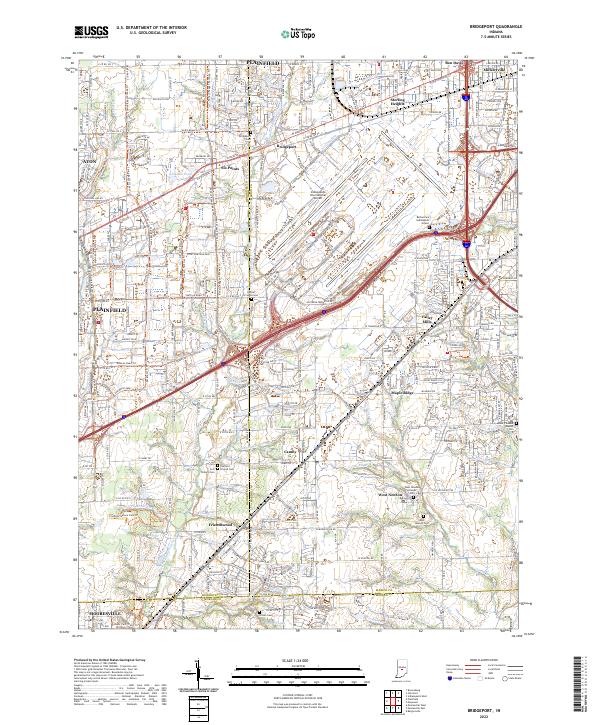
1959 Map of Bridgeport
USGS Topo · Published 1960About this map
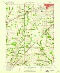
Bridgeport and Mickleyville sit along the busy transit corridor of the National Road and the Pennsylvania Railroad in this late-1950s survey of southwestern Marion County. The landscape shows a distinct transition between the expanding suburban reach of the Indianapolis city boundary and the rural agricultural tracts of Guilford and Decatur townships. Significant landmarks from this era include the Municipal Airport and Old Ben Davis High Sch, alongside recreational spaces like Jameson Camp and a Drive-in Theater. To the south, smaller communities such as West Newton, Camby, and Friendswood maintain their identities amidst a network of small waterways like White Lick Creek and Goose Creek. Genealogists will find value in the placement of Center Cem and rural congregations such as Bethel Ch and Mt Pleasant Ch, which anchored these developing communities before the full onset of modern suburban sprawl.
Find a feature on this map
92 named features on this map. Tap any name to fly to it.
Don’t see what you’re looking for? This feature index may not catch every label — zoom into the map to look around manually.
Map Details
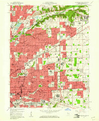
Editions of this 1959 Bridgeport Map
This is the sole edition of this map. No revisions or reprints were ever made.
Historical Maps of Indianapolis Through Time
36 maps found
1948 Indianapolis East
Marion County, IN
1948 Indianapolis West
Marion County, IN
1948 Maywood
Marion County, IN
1953 Bridgeport
Marion County, IN
1959 Bridgeport
Marion County, IN
1959 Indianapolis East
Marion County, IN
1959 Indianapolis West
Marion County, IN
1959 Maywood
Marion County, IN
1966 Bridgeport
Marion County, IN
1967 Indianapolis East
Marion County, IN
1967 Indianapolis West
Marion County, IN
1967 Maywood
Marion County, IN
1998 Bridgeport
Marion County, IN
1998 Indianapolis East
Marion County, IN
1998 Indianapolis West
Marion County, IN
1998 Maywood
Marion County, IN
2010 Bridgeport
Marion County, IN
2010 Indianapolis East
Marion County, IN
2010 Indianapolis West
Marion County, IN
2011 Maywood
Marion County, IN
2013 Bridgeport
Marion County, IN
2013 Indianapolis East
Marion County, IN
2013 Indianapolis West
Marion County, IN
2013 Maywood
Marion County, IN
2016 Bridgeport
Marion County, IN
2016 Indianapolis East
Marion County, IN
2016 Indianapolis West
Marion County, IN
2016 Maywood
Marion County, IN
2019 Bridgeport
Marion County, IN
2019 Indianapolis East
Marion County, IN
2019 Indianapolis West
Marion County, IN
2019 Maywood
Marion County, IN
2022 Bridgeport
Marion County, IN
2022 Indianapolis East
Marion County, IN
2022 Indianapolis West
Marion County, IN
2022 Maywood
Marion County, IN