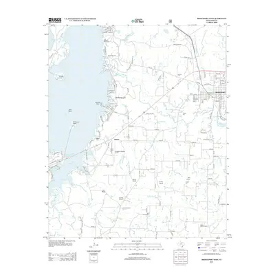
2013 Map of Bridgeport West
USGS Topo · Published 2013About this map
Lake Bridgeport dominates the western landscape of this Wise County region, characterized by its complex shoreline of points and islands like Stripling Island and Rattlesnake Island. To the east, the city of Bridgeport is shown with its established street grid and the BNSF Railway corridor. The interior terrain is marked by distinctive elevations known as mounds, including Bowlin Mound and East Mound, which served as local landmarks and burial sites such as the E Mound Cem.
Find a feature on this map
134 named features on this map. Tap any name to fly to it.
Don’t see what you’re looking for? This feature index may not catch every label — zoom into the map to look around manually.
Map Details
Editions of this 2013 Bridgeport West Map
This is the sole edition of this map. No revisions or reprints were ever made.
Other maps of this area

1930 · Boyd
USGS Topo · 1:62,500

1954 · Sherman
USGS Topo · 1:250,000

1958 · Sherman
USGS Topo · 1:250,000

1960 · Bridgeport West
USGS Topo · 1:24,000

1960 · Bridgeport East
USGS Topo · 1:24,000

1960 · Gibtown
USGS Topo · 1:24,000

1960 · Cottondale
USGS Topo · 1:24,000

1960 · Wizard Wells
USGS Topo · 1:24,000
1960 · Boonsville
USGS Topo · 1:24,000

1961 · Alvord
USGS Topo · 1:24,000