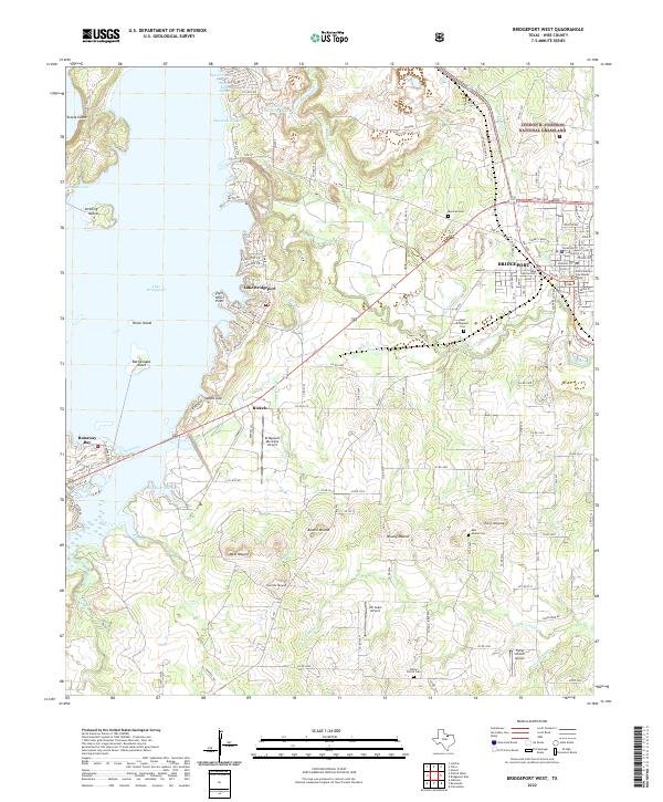
2022 Map of Bridgeport West
USGS Topo · Published 2022About this map
Lake Bridgeport and the winding West Fork Trinity River dominate the landscape west of Bridgeport, where the prairie transitions into the hills of Wise County. The map documents a blend of lakeside recreation at Runaway Bay and industrial activity, including the Lone Star Industries Lake and the Wise County Courthouse Annex. Genealogical value is found in several rural burial grounds such as Mexican Cem and Wilson Prairie Cem, while the aviation history of the region is anchored by Bridgeport Municipal Airport and Jim Sears Airport.
Find a feature on this map
133 named features on this map. Tap any name to fly to it.
Don’t see what you’re looking for? This feature index may not catch every label — zoom into the map to look around manually.
Map Details
Editions of this 2022 Bridgeport West Map
This is the sole edition of this map. No revisions or reprints were ever made.
Other maps of this area

1930 · Boyd
USGS Topo · 1:62,500

1954 · Sherman
USGS Topo · 1:250,000

1958 · Sherman
USGS Topo · 1:250,000

1960 · Bridgeport West
USGS Topo · 1:24,000

1960 · Bridgeport East
USGS Topo · 1:24,000

1960 · Gibtown
USGS Topo · 1:24,000

1960 · Cottondale
USGS Topo · 1:24,000

1960 · Wizard Wells
USGS Topo · 1:24,000
1960 · Boonsville
USGS Topo · 1:24,000

1961 · Alvord
USGS Topo · 1:24,000