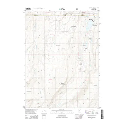
2014 Map of Bridger Lake
USGS Topo · Published 2014About this map
The Wasatch National Forest dominates this high-altitude landscape along the border of Utah and Wyoming. The map documents a complex system of water management and recreation centered around the forks of the Smiths Fork. Large bodies of water like Stateline Reservoir and Grahams Reservoir are prominent, alongside natural features such as Bridger Lake and Marsh Lake. The geography is defined by a series of high-elevation openings including Johnson Meadows, Gilbert Meadow, and China Meadows, which provide clearings amidst the timbered forest. This 2014 survey serves as a modern record of the infrastructure supporting the region's wilderness access, noting several organized sites like the Bridger Lake Campground and Trail Head Campground. The map also traces the distinct drainage patterns of the W Fork Smiths Fork and E Fork Smiths Fork, illustrating how these waterways carve through the plateau terrain.
Find a feature on this map
26 named features on this map. Tap any name to fly to it.
Don’t see what you’re looking for? This feature index may not catch every label — zoom into the map to look around manually.
Map Details
Editions of this 2014 Bridger Lake Map
This is the sole edition of this map. No revisions or reprints were ever made.
Other maps of this area

1885 · Uinta
USGS Topo · 1:250,000

1901 · Hayden Peak
USGS Topo · 1:125,000

1903 · Hayden Peak
USGS Topo · 1:125,000

1905 · Gilbert Peak
USGS Topo · 1:125,000

1906 · Gilbert Peak
USGS Topo · 1:125,000

1954 · Salt Lake City
USGS Topo · 1:250,000

1954 · Ogden
USGS Topo · 1:250,000

1958 · Ogden
USGS Topo · 1:250,000

1958 · Salt Lake City
USGS Topo · 1:250,000

1960 · Ogden
USGS Topo · 1:250,000