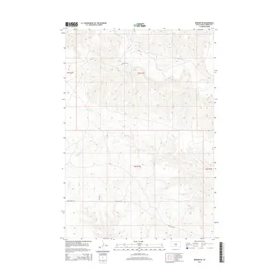
2015 Map of Bridger NE
USGS Topo · Published 2015About this map
Saint Marks Cem sits atop the high ground of Ziebach County, overlooking a network of creek beds that define this portion of the Cheyenne River Indian Reservation. The landscape is carved by the drainages of Cherry Cr, Felix Cr, and N Felix Cr, which create a complex topography of ridges and draws. These watercourses dictate the path of local travel, with Cherry Creek Rd skirting the southern draws while Bureau of Indian Affairs routes like Bia-13 and Bia-6 provide access across the township lines of T9N and T8N. The map reveals a sparsely populated area where land use is tied closely to the natural hydrology of Dog Cr and its neighbors, offering a clear view of the rural infrastructure and cemetery locations essential for genealogical research in this part of South Dakota.
Find a feature on this map
12 named features on this map. Tap any name to fly to it.
Don’t see what you’re looking for? This feature index may not catch every label — zoom into the map to look around manually.
Map Details
Editions of this 2015 Bridger NE Map
This is the sole edition of this map. No revisions or reprints were ever made.
Other maps of this area

1954 · Pierre
USGS Topo · 1:250,000

1955 · Bridger
USGS Topo · 1:24,000

1955 · Rattlesnake Lake SW
USGS Topo · 1:24,000

1955 · Rattlesnake Lake
USGS Topo · 1:24,000

1955 · Bridger SE
USGS Topo · 1:24,000

1958 · Pierre
USGS Topo · 1:250,000

1982 · Chasing Hawk Draw
USGS Topo · 1:24,000

1982 · Dead Horse Draw
USGS Topo · 1:24,000

1982 · Bridger NE
USGS Topo · 1:24,000

1982 · Red Scaffold
USGS Topo · 1:24,000