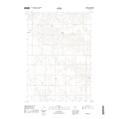
2017 Map of Bridger NE
USGS Topo · Published 2017About this map
Saint Mark's Cem stands as a focal point in this section of Ziebach County, situated on the high ground between local drainages. The landscape is defined by the branching tributaries of the Cheyenne River watershed, notably Cherry Cr which meanders through the northern sections and Felix Cr cutting across the central plains. Transportation in this part of South Dakota relies on a network of Bureau of Indian Affairs routes and local roads such as Red Scaffold Rd and Tankini Rd, which connect remote ranching interests and tribal lands. This 2017 survey illustrates the sparse, high-plains settlement pattern where large tracts of land are primarily divided by natural water features like N Felix Cr and Dog Cr, reflecting the region's enduring character as an open grazing and agricultural territory.
Find a feature on this map
14 named features on this map. Tap any name to fly to it.
Don’t see what you’re looking for? This feature index may not catch every label — zoom into the map to look around manually.
Map Details
Editions of this 2017 Bridger NE Map
This is the sole edition of this map. No revisions or reprints were ever made.
Other maps of this area

1954 · Pierre
USGS Topo · 1:250,000

1955 · Bridger
USGS Topo · 1:24,000

1955 · Rattlesnake Lake SW
USGS Topo · 1:24,000

1955 · Rattlesnake Lake
USGS Topo · 1:24,000

1955 · Bridger SE
USGS Topo · 1:24,000

1958 · Pierre
USGS Topo · 1:250,000

1982 · Chasing Hawk Draw
USGS Topo · 1:24,000

1982 · Dead Horse Draw
USGS Topo · 1:24,000

1982 · Bridger NE
USGS Topo · 1:24,000

1982 · Red Scaffold
USGS Topo · 1:24,000