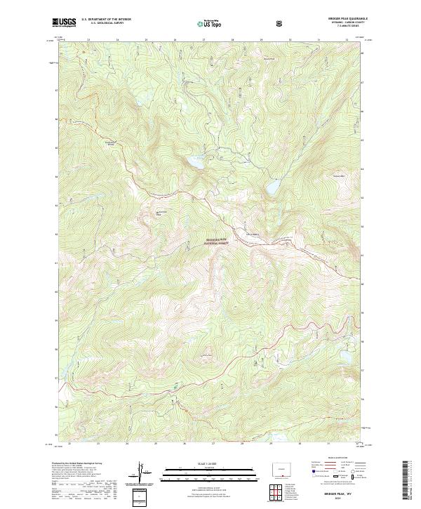
2021 Map of Bridger Peak
USGS Topo · Published 2021About this map
The Sierra Madre range dominates this high-altitude landscape within the Medicine Bow National Forest. The Continental Divide winds through the western half of the terrain, followed closely by the Continental Divide National Scenic Trl. This portion of the divide separates complex drainage systems, with Jack Creek and North Spring Creek flowing northward, while Battle Creek and its tributaries, such as Haskins Creek and Smith Creek, carve through the southern slopes. High mountain peaks including Mowry Peak, McCormick Peak, and Vulcan Mountain define the horizon, interspersed with alpine water bodies like Battle Lake and the North Spring Creek Lake. Evidence of water management for lower elevations appears at Belvidere Ditch, while the primitive road and trail network, including the Continental Divide Atv Trl and Baby Lake Trail, indicates the area's use for recreation and forest management.
Find a feature on this map
41 named features on this map. Tap any name to fly to it.
Don’t see what you’re looking for? This feature index may not catch every label — zoom into the map to look around manually.
Map Details
Editions of this 2021 Bridger Peak Map
This is the sole edition of this map. No revisions or reprints were ever made.
Other maps of this area

1932 · Savery
USGS Topo · 1:96,000

1939 · Saratoga
USGS Topo · 1:125,000

1940 · Savery
USGS Topo · 1:125,000

1954 · Rawlins
USGS Topo · 1:250,000

1958 · Rawlins
USGS Topo · 1:250,000

1961 · Red Mountain
USGS Topo · 1:24,000

1961 · Divide Peak
USGS Topo · 1:24,000

1961 · Bridger Peak
USGS Topo · 1:24,000
1961 · Singer Peak
USGS Topo · 1:24,000
1961 · Indian Rocks
USGS Topo · 1:24,000