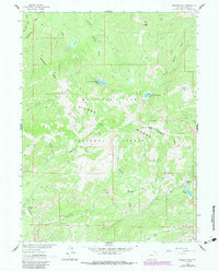
1983 Map of Bridger Peak
USGS Topo · Published 1988About this map
The Continental Divide winds through this high-altitude section of the Sierra Madre within the Medicine Bow National Forest. This terrain is defined by its early 20th-century mining history, evidenced by several former townsites that supported the extraction of copper and other minerals. Notable among these is the Ferris-Haggarty Mine and the nearby Rudefeha (Site), once significant centers of activity in the Encampment district.
Find a feature on this map
39 named features on this map. Tap any name to fly to it.
Don’t see what you’re looking for? This feature index may not catch every label — zoom into the map to look around manually.
Map Details
Editions of this 1983 Bridger Peak Map
This is the sole edition of this map. No revisions or reprints were ever made.
Other maps of this area

1932 · Savery
USGS Topo · 1:96,000

1939 · Saratoga
USGS Topo · 1:125,000

1940 · Savery
USGS Topo · 1:125,000

1954 · Rawlins
USGS Topo · 1:250,000

1958 · Rawlins
USGS Topo · 1:250,000

1961 · Red Mountain
USGS Topo · 1:24,000

1961 · Divide Peak
USGS Topo · 1:24,000

1961 · Bridger Peak
USGS Topo · 1:24,000
1961 · Singer Peak
USGS Topo · 1:24,000
1961 · Indian Rocks
USGS Topo · 1:24,000