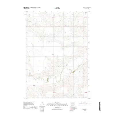
2017 Map of Bridger SE
USGS Topo · Published 2017About this map
The Cheyenne River carves a winding path across the southern reaches of this landscape, marking the natural boundary between Ziebach County and Haakon County. This 2017 survey reveals a terrain defined by deep drainage systems and secluded water sources, including Black Bull Spring, Jackson Spring, and Hold Spring. The topography is a complex network of named draws and flats, such as the prominent Hump Flat and the shadowed recesses of Clayton Draw and Council Bear Draw.
Find a feature on this map
23 named features on this map. Tap any name to fly to it.
Don’t see what you’re looking for? This feature index may not catch every label — zoom into the map to look around manually.
Map Details
Editions of this 2017 Bridger SE Map
This is the sole edition of this map. No revisions or reprints were ever made.
Other maps of this area

1954 · Pierre
USGS Topo · 1:250,000

1955 · Bridger
USGS Topo · 1:24,000

1955 · Rattlesnake Lake SW
USGS Topo · 1:24,000

1955 · Rattlesnake Lake
USGS Topo · 1:24,000

1955 · Bridger SE
USGS Topo · 1:24,000

1955 · Hilland NW
USGS Topo · 1:24,000

1958 · Pierre
USGS Topo · 1:250,000

1982 · Dead Horse Draw
USGS Topo · 1:24,000

1982 · Bridger NE
USGS Topo · 1:24,000

1983 · Philip
USGS Topo · 1:100,000