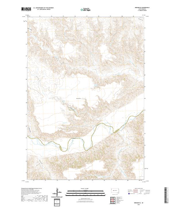
2021 Map of Bridger SE
USGS Topo · Published 2021About this map
The Cheyenne River winds through the southern reaches of this landscape, marking the county line where Ziebach County meets Haakon County. This region is defined by an intricate network of drainages and springs that provide critical water sources in a semi-arid environment. Named water features such as Black Bull Spring, Jackson Spring, and Hold Spring are scattered throughout the terrain, often located near significant flats and draws. The plateau of Hump Flat stands as a prominent topographical feature in the center of the survey area, surrounded by a complex system of creek beds including Bull Creek, Dog Creek, and Council Bear Creek. These waterways and their associated draws, like Moon Draw and Clayton Draw, reveal the erosion patterns typical of this part of South Dakota, where the land has been sculpted over generations by the movement of water toward the Cheyenne River valley.
Find a feature on this map
23 named features on this map. Tap any name to fly to it.
Don’t see what you’re looking for? This feature index may not catch every label — zoom into the map to look around manually.
Map Details
Editions of this 2021 Bridger SE Map
This is the sole edition of this map. No revisions or reprints were ever made.
Other maps of this area

1954 · Pierre
USGS Topo · 1:250,000

1955 · Bridger
USGS Topo · 1:24,000

1955 · Rattlesnake Lake SW
USGS Topo · 1:24,000

1955 · Rattlesnake Lake
USGS Topo · 1:24,000

1955 · Bridger SE
USGS Topo · 1:24,000

1955 · Hilland NW
USGS Topo · 1:24,000

1958 · Pierre
USGS Topo · 1:250,000

1982 · Dead Horse Draw
USGS Topo · 1:24,000

1982 · Bridger NE
USGS Topo · 1:24,000

1983 · Philip
USGS Topo · 1:100,000