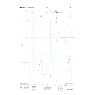
2013 Map of Bridgewater
USGS Topo · Published 2013About this map
Bridgewater sits at the northern edge of this Adair County landscape, where the local road network centers on the intersection of W 1st St and Bridgewater Rd. The surrounding countryside is defined by the branching hydrography of the Nodaway river system, including the W Nodaway River and the Middle Nodaway River. These waterways, along with tributaries like Thompson Cr and Elm Cr, create a dendritic drainage pattern across the agricultural terrain. A notable cultural landmark is Camp Eo-wa-ta, located east of the main town. The map documents a highly structured rural grid of section-line roads, such as Tucson Rd and Wichita Rd, which illustrate the persistent organization of Iowa's farmland in the early 21st century.
Find a feature on this map
55 named features on this map. Tap any name to fly to it.
Don’t see what you’re looking for? This feature index may not catch every label — zoom into the map to look around manually.
Map Details
Editions of this 2013 Bridgewater Map
This is the sole edition of this map. No revisions or reprints were ever made.
Other maps of this area

1954 · Omaha
USGS Topo · 1:250,000

1957 · Omaha
USGS Topo · 1:250,000

1958 · Omaha
USGS Topo · 1:250,000

1971 · Fontanelle
USGS Topo · 1:24,000

1971 · Massena
USGS Topo · 1:24,000

1971 · Fontanelle SW
USGS Topo · 1:24,000

1980 · Nevinville
USGS Topo · 1:24,000

1980 · Corning North
USGS Topo · 1:24,000

1980 · Bridgewater
USGS Topo · 1:24,000
1980 · Carbon
USGS Topo · 1:24,000