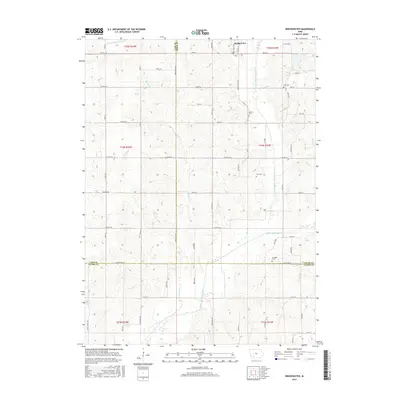
2015 Map of Bridgewater
USGS Topo · Published 2015About this map
Bridgewater sits at the intersection of rural townships in this modern survey of Southwest Iowa, where the landscape is defined by the intricate branching of the Middle Nodaway River and its tributaries. The terrain is structured by a rigorous grid of section roads, including Co Hwy G61 and Sidney Rd, which navigate the undulating divides between Thompson Cr and Elm Cr. To the northeast, the Mormon Trail Lake provides a notable hydrologic landmark near the Adair County border.
Find a feature on this map
41 named features on this map. Tap any name to fly to it.
Don’t see what you’re looking for? This feature index may not catch every label — zoom into the map to look around manually.
Map Details
Editions of this 2015 Bridgewater Map
This is the sole edition of this map. No revisions or reprints were ever made.
Other maps of this area

1954 · Omaha
USGS Topo · 1:250,000

1957 · Omaha
USGS Topo · 1:250,000

1958 · Omaha
USGS Topo · 1:250,000

1971 · Fontanelle
USGS Topo · 1:24,000

1971 · Massena
USGS Topo · 1:24,000

1971 · Fontanelle SW
USGS Topo · 1:24,000

1980 · Nevinville
USGS Topo · 1:24,000

1980 · Corning North
USGS Topo · 1:24,000

1980 · Bridgewater
USGS Topo · 1:24,000
1980 · Carbon
USGS Topo · 1:24,000