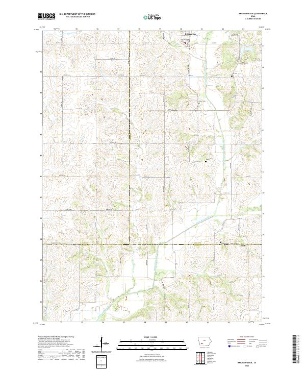
2022 Map of Bridgewater
USGS Topo · Published 2022About this map
Bridgewater sits at the northern edge of this agricultural landscape where several branches of the Nodaway River system converge. The terrain is defined by the winding courses of the W Nodaway River and the Middle Nodaway River, which are fed by smaller tributaries like Elm Cr and Thompson Cr. This area, spanning the borders of Adair, Cass, and Adams counties, maintains a consistent grid of section roads that provide access to isolated farmsteads and historical burial grounds. Genealogists will find several notable local landmarks including the Witt Cem, Garner Cem, and Winn Cem. The presence of Campbell Cem near the southern boundary further highlights the rural community's long-standing connection to this corner of Southwest Iowa. The map's detail reflects a landscape of intensive farming and riparian corridors that have shaped the region's development for generations.
Find a feature on this map
52 named features on this map. Tap any name to fly to it.
Don’t see what you’re looking for? This feature index may not catch every label — zoom into the map to look around manually.
Map Details
Editions of this 2022 Bridgewater Map
This is the sole edition of this map. No revisions or reprints were ever made.
Other maps of this area

1954 · Omaha
USGS Topo · 1:250,000

1957 · Omaha
USGS Topo · 1:250,000

1958 · Omaha
USGS Topo · 1:250,000

1971 · Fontanelle
USGS Topo · 1:24,000

1971 · Massena
USGS Topo · 1:24,000

1971 · Fontanelle SW
USGS Topo · 1:24,000

1980 · Nevinville
USGS Topo · 1:24,000

1980 · Corning North
USGS Topo · 1:24,000

1980 · Bridgewater
USGS Topo · 1:24,000
1980 · Carbon
USGS Topo · 1:24,000