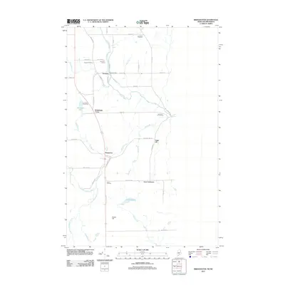
2011 Map of Bridgewater
USGS Topo · Published 2011About this map
Prestile Stream winds southward through the center of this Maine landscape, passing through the village of Robinson, where the Robinson Dam remains a notable landmark on the water. This 2011 survey captures the town of Bridgewater and the smaller Snow Settlement near the international boundary, a region defined by its agricultural road network and scattered burial grounds. Local genealogists will find several preserved sites, including East Blaine Cemetery, Sanborn Cemetery, and Smith Cemetery, which document the long-standing families of the area.
Find a feature on this map
50 named features on this map. Tap any name to fly to it.
Don’t see what you’re looking for? This feature index may not catch every label — zoom into the map to look around manually.
Map Details
Editions of this 2011 Bridgewater Map
This is the sole edition of this map. No revisions or reprints were ever made.
Other maps of this area

1934 · Bridgewater
USGS Topo · 1:48,000

1936 · Mars Hill
USGS Topo · 1:48,000

1938 · Bridgewater
USGS Topo · 1:62,500

1940 · Mars Hill
USGS Topo · 1:62,500

1951 · Mars Hill
USGS Topo · 1:62,500

1951 · Bridgewater
USGS Topo · 1:62,500

1953 · Bridgewater
USGS Topo · 1:50,000

1959 · Woodstock
USGS Topo · 1:250,000

1963 · Woodstock
USGS Topo · 1:250,000
1975 · Mars Hill SE
USGS Topo · 1:24,000