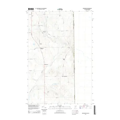
2014 Map of Bridgewater
USGS Topo · Published 2014About this map
The international border with Canada forms the eastern edge of this Aroostook County landscape, where the agricultural and timber patterns of Northern Maine are etched into the terrain. Prestile Stream winds southeast through the center of the sheet, passing the settlement of Robinson and the town of Bridgewater. This area preserves a high density of small family and community burial grounds, including Tapley Cem, Sanborn Cem, and East Blaine Cem, which are scattered among the ridges and brooks. The road network, including Us-1 and Military Rd, connects these rural outposts with historic points like Bridgewater Corner and the aptly named Snow Settlement. To the south, the landscape transitions toward Portland Lake and the marshy reaches of Dead Stream, illustrating the drainage patterns that defined local land use and early settlement before modern development shifted the focus toward the primary highway corridors.
Find a feature on this map
55 named features on this map. Tap any name to fly to it.
Don’t see what you’re looking for? This feature index may not catch every label — zoom into the map to look around manually.
Map Details
Editions of this 2014 Bridgewater Map
This is the sole edition of this map. No revisions or reprints were ever made.
Other maps of this area

1934 · Bridgewater
USGS Topo · 1:48,000

1936 · Mars Hill
USGS Topo · 1:48,000

1938 · Bridgewater
USGS Topo · 1:62,500

1940 · Mars Hill
USGS Topo · 1:62,500

1951 · Mars Hill
USGS Topo · 1:62,500

1951 · Bridgewater
USGS Topo · 1:62,500

1953 · Bridgewater
USGS Topo · 1:50,000

1959 · Woodstock
USGS Topo · 1:250,000

1963 · Woodstock
USGS Topo · 1:250,000
1975 · Mars Hill SE
USGS Topo · 1:24,000