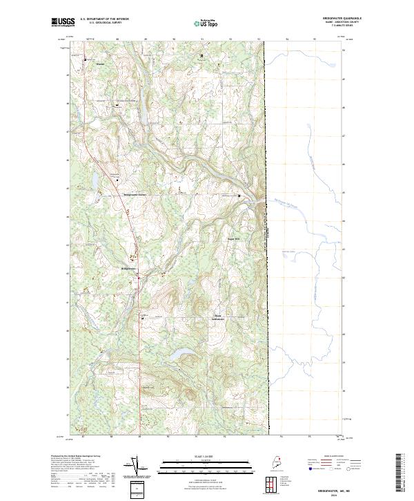
2024 Map of Bridgewater
USGS Topo · Published 2024About this map
Blaine and Bridgewater sit along the Main Rd corridor in this eastern Maine landscape, where the international boundary with Canada defines the eastern edge of the quadrangle. The area is characterized by a network of rural settlements and agricultural roads, such as Robinson Rd and Boundary Line Rd, that weave between the drainage of Prestile Stream and Whitney Brook. Genealogical researchers will find several small burial grounds scattered throughout the township, including Smith Cem, Tapley Cem, and Sanborn Cem. Notable landforms like Sugar Hill and Bunker Hill rise above the stream valleys, while the Snow Settlement and the Wesleyan Campground Rd suggest historical community centers. The map also traces the winding courses of Big Presque Isle Stream and Dead Stream, illustrating the water-rich geography that has long shaped the development of southern Aroostook County.
Find a feature on this map
55 named features on this map. Tap any name to fly to it.
Don’t see what you’re looking for? This feature index may not catch every label — zoom into the map to look around manually.
Map Details
Editions of this 2024 Bridgewater Map
This is the sole edition of this map. No revisions or reprints were ever made.
Other maps of this area

1934 · Bridgewater
USGS Topo · 1:48,000

1936 · Mars Hill
USGS Topo · 1:48,000

1938 · Bridgewater
USGS Topo · 1:62,500

1940 · Mars Hill
USGS Topo · 1:62,500

1951 · Mars Hill
USGS Topo · 1:62,500

1951 · Bridgewater
USGS Topo · 1:62,500

1953 · Bridgewater
USGS Topo · 1:50,000

1959 · Woodstock
USGS Topo · 1:250,000

1963 · Woodstock
USGS Topo · 1:250,000
1975 · Mars Hill SE
USGS Topo · 1:24,000