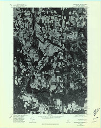
1975 Map of Bridgewater NE
USGS Topo · Published 1981About this map
Prestile Stream winds through a landscape of agricultural clearings and dense woods along the international border in this mid-1970s orthophoto. The settlement of Bridgewater serves as a primary hub, while smaller crossroads and hamlets such as Robinsons and Bridgewater Corner are scattered through the countryside. This aerial survey captures the specific land-use patterns of the era, where the irregular patchwork of fields meets the rugged timberlands of Aroostook County. To the east, the Maine-New Brunswick line is a prominent boundary, separating these American communities from their neighbors in Canada. Water features like Portland Lake and the slow-moving Dead Stream define the low-lying areas, while Sugar Hill provides a point of elevation amidst the productive farmland and rural dwellings.
Find a feature on this map
13 named features on this map. Tap any name to fly to it.
Don’t see what you’re looking for? This feature index may not catch every label — zoom into the map to look around manually.
Map Details
Editions of this 1975 Bridgewater NE Map
This is the sole edition of this map. No revisions or reprints were ever made.
Other maps of this area

1934 · Bridgewater
USGS Topo · 1:48,000

1936 · Mars Hill
USGS Topo · 1:48,000

1938 · Bridgewater
USGS Topo · 1:62,500

1940 · Mars Hill
USGS Topo · 1:62,500

1951 · Mars Hill
USGS Topo · 1:62,500

1951 · Bridgewater
USGS Topo · 1:62,500

1953 · Bridgewater
USGS Topo · 1:50,000

1959 · Woodstock
USGS Topo · 1:250,000

1963 · Woodstock
USGS Topo · 1:250,000
1975 · Mars Hill SE
USGS Topo · 1:24,000