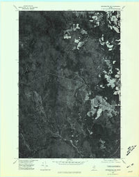
1975 Map of Bridgewater NW
USGS Topo · Published 1981About this map
The North Branch Meduxnekeag River winds through this heavily forested section of Aroostook County, appearing as it did in the mid-1970s. This orthophotoquad provides an aerial perspective of the northern Maine woods, where the transition from dense timberland to small, scattered agricultural clearings is starkly visible. Isolated water bodies like Ketchum Lake and Packard Lake sit remote from any major settlements, while the prominent height of Nineteen Mountain anchors the western portion of the terrain. The landscape is defined by its drainage patterns, with Three Brooks carving through the northeastern quadrant. This imagery captures the region just before modern industrial forestry shifted the visual texture of the North Woods, showing the traditional patchwork of logging roads and small farms that defined local land use for generations.
Find a feature on this map
5 named features on this map. Tap any name to fly to it.
Don’t see what you’re looking for? This feature index may not catch every label — zoom into the map to look around manually.
Map Details
Editions of this 1975 Bridgewater NW Map
This is the sole edition of this map. No revisions or reprints were ever made.
Other maps of this area

1934 · Bridgewater
USGS Topo · 1:48,000

1935 · Howe Brook
USGS Topo · 1:48,000

1935 · Presque Isle
USGS Topo · 1:62,500

1936 · Mars Hill
USGS Topo · 1:48,000

1938 · Bridgewater
USGS Topo · 1:62,500

1939 · Howe Brook
USGS Topo · 1:62,500

1940 · Mars Hill
USGS Topo · 1:62,500

1951 · Mars Hill
USGS Topo · 1:62,500

1951 · Bridgewater
USGS Topo · 1:62,500

1953 · Bridgewater
USGS Topo · 1:50,000