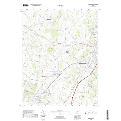
2019 Map of Bridgewater
USGS Topo · Published 2019About this map
Bridgewater and Harrisonburg anchor this survey of the Shenandoah Valley, where academic institutions and historic crossroads define the local geography. The presence of Eastern Mennonite University in Park View and Bridgewater College near the North River reflects the region's long-standing educational heritage. The landscape is punctuated by prominent geological features such as the volcanic Mole Hill and Shavers Hill, while water resources like Silver Lake and Mill Pond Spring influenced the early settlement patterns of villages like Dayton. Numerous burial grounds, including Saint Jacobs Spaders Cem and Mount Horeb Cem, provide significant touchstones for genealogical research. The map also traces the established transportation network, from the Rawley Pike to the rural paths connecting smaller communities like Stemphleytown and Dale Enterprise.
Find a feature on this map
211 named features on this map. Tap any name to fly to it.
Don’t see what you’re looking for? This feature index may not catch every label — zoom into the map to look around manually.
Map Details
Editions of this 2019 Bridgewater Map
This is the sole edition of this map. No revisions or reprints were ever made.
Other maps of this area

1892 · Franklin
USGS Topo · 1:125,000

1892 · Woodstock
USGS Topo · 1:125,000

1892 · Harrisonburg
USGS Topo · 1:125,000

1894 · Staunton
USGS Topo · 1:125,000

1896 · Franklin
USGS Topo · 1:125,000

1922 · Fort Seybert
USGS Topo · 1:48,000

1924 · Fort Seybert
USGS Topo · 1:62,500

1941 · Harrisonburg
USGS Topo · 1:62,500

1943 · Harrisonburg
USGS Topo · 1:62,500

1944 · Parnassus
USGS Topo · 1:62,500