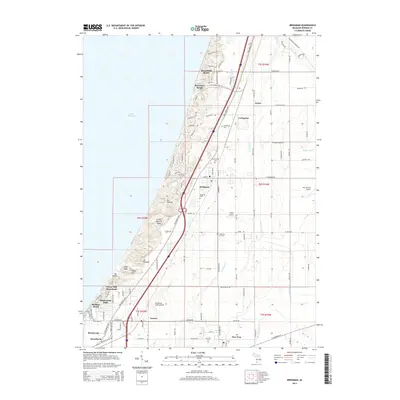
2014 Map of Bridgman
USGS Topo · Published 2014About this map
Bridgman and the surrounding Berrien County shoreline are defined by a mix of coastal resort communities and inland agricultural plots during the early 21st century. The lakefront is punctuated by distinctive high dunes such as Great Warren Dune, Mt Randall, and Mt Edward, which separate the waters of Lake Michigan from the residential developments of Waverland Beach and Bethany Beach. Inland, the map reveals a history of local education and burial grounds through sites like the California Sch Cem and Graceland Cem. The transportation network is anchored by the Red Arrow Hwy, connecting established centers like Sawyer and New Troy. Small-scale aviation history is also present, with private facilities like Myers Airport and Southwest Lakes Airpark scattered throughout the rural landscape.
Find a feature on this map
83 named features on this map. Tap any name to fly to it.
Don’t see what you’re looking for? This feature index may not catch every label — zoom into the map to look around manually.
Map Details
Editions of this 2014 Bridgman Map
This is the sole edition of this map. No revisions or reprints were ever made.
Other maps of this area

1927 · Niles
USGS Topo · 1:62,500

1927 · Benton Harbor
USGS Topo · 1:62,500

1930 · Three Oaks
USGS Topo · 1:62,500

1930 · Benton Harbor
USGS Topo · 1:62,500

1930 · Niles
USGS Topo · 1:62,500

1943 · Niles
USGS Topo · 1:62,500

1944 · Three Oaks
USGS Topo · 1:62,500

1953 · Chicago
USGS Topo · 1:250,000

1957 · Chicago
USGS Topo · 1:250,000

1958 · Racine
USGS Topo · 1:250,000