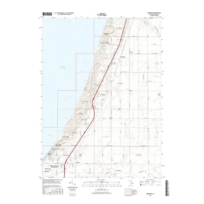
2017 Map of Bridgman
USGS Topo · Published 2017About this map
Lake Michigan defines the western edge of this Berrien County landscape, where the shifting sands of the Great Warren Dune rise alongside a series of named summits including Pikes Peak, Mt Edward, and Tower Hill. The shoreline is dotted with established residential communities such as Waverland Beach, Rosemary Beach, and Bethany Beach, while the interior centers on the city of Bridgman. This 2017 survey illustrates the complex drainage network feeding the lake, including the Thornton Valley Drain and Kirktown Cr, which cut through the coastal topography.
Find a feature on this map
104 named features on this map. Tap any name to fly to it.
Don’t see what you’re looking for? This feature index may not catch every label — zoom into the map to look around manually.
Map Details
Editions of this 2017 Bridgman Map
This is the sole edition of this map. No revisions or reprints were ever made.
Other maps of this area

1927 · Niles
USGS Topo · 1:62,500

1927 · Benton Harbor
USGS Topo · 1:62,500

1930 · Three Oaks
USGS Topo · 1:62,500

1930 · Benton Harbor
USGS Topo · 1:62,500

1930 · Niles
USGS Topo · 1:62,500

1943 · Niles
USGS Topo · 1:62,500

1944 · Three Oaks
USGS Topo · 1:62,500

1953 · Chicago
USGS Topo · 1:250,000

1957 · Chicago
USGS Topo · 1:250,000

1958 · Racine
USGS Topo · 1:250,000